Ghostly Monks and a Vanishing Army
Sunday 18th January 2025, Laughton en le Morthen, Roche Abbey
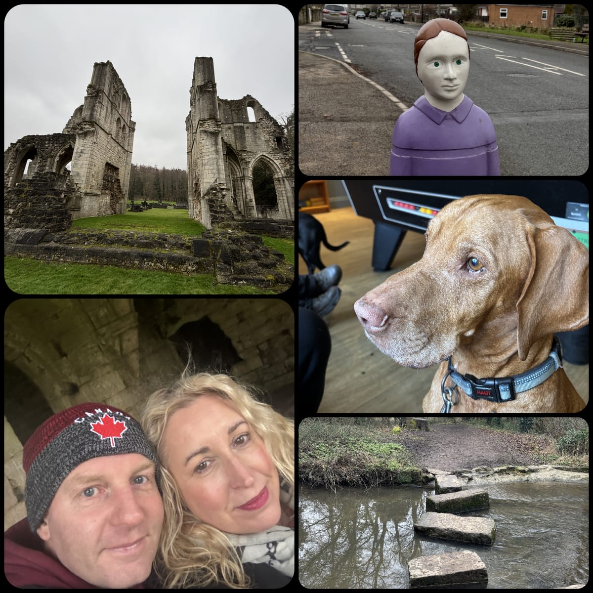
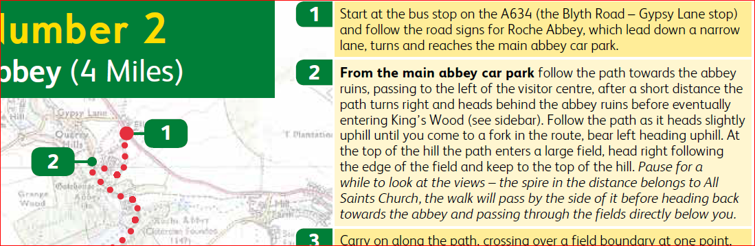
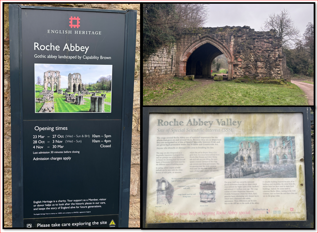
Time for a change, and this time our planned route took us into the heart of South Yorkshire. Roche Abbey is featured in a multitude of YouTube clips from a variety of Paranormal Investigators, and so we felt that we should definitely check it out. The Abbey is an English Heritage site and you have to pay to enter the grounds... and it is only open at certain times of the year - January not being one of them! Fortunately, the site is very easily viewed through the wire fence around its perimeter and this is where our walk began. The walk was found as an online pdf - you can access it here . (I will provide the link again, and with more details later).
It was a very enjoyable walk, but quite steep in places with some narrow footpaths and a few stiles. We had to carry Monty over one of them! There is also a questionable estimate in length. The map clearly states that this is a 4 mile walk. Considering that we started half a mile into the walk in the Abbey Car Park, and then we followed the map to the letter, (it was very straightforward) both Garmin and Strava clocked it in at 6.27 Miles. Something to consider!
Well, let's get on with the stories...
A Ghostly Monk
An online search will quickly throw up a number of paranormal investigations at Roche Abbey. Many of these relate to the appearance of a solitary Monk. Despite these modern sightings and even some alleged photographic and video images of the Monk, I have been unable to find any narrative or background to explain this presence. I'm not going to link of the of the sources as there are too many, and an internet search will immediately bring up a lot of options!
There is no specific story of a haunting, but the monastery originally on the site was Cistercian and the religious inhabitants were known locally as 'The White Monks'. Walter Daniel was a monk at nearby Rievaulx Abbey from the year 1150, joining the order when he was 25 years old. He wrote a biography of a previous Abbot, "The Life of Aelred of Rievaulx", in which he references at time to Roche Abbey. In one small section he relates how the devil once visited the Monks Dormitory at Roche Abbey. There is little detail - but perhaps the Monk whose cell was visited has remained, at least in spirit, at the Abbey.
The Vanishing Army
Perhaps more interesting is another ancient story. Sadly we have no first hand witness accounts, but Matthew Paris who was a Monk in St. Albans did write a chronicle of Roche Abbey. He described in detail ghostly spectres who appeared in 1236. He does claim that the story comes from reliable witnesses including Richard, the Earl of Gloucester.
The account describes how, in May 1236, the community and local people were all shocked to see organised lines of fully armed knights appear as if from thin air. They wore chainmail and helmets; carried shields and standards. Locals were terrified and transfixed, even more so when the knights dismounted and began fighting, creating an echoing crescendo of noise. These sounds drew even more observers. No one dared approach them - feeling an overwhelming sense of dread if they attempted to get too close.
This strange manifestation lasted a number of day, drawing more and more onlookers, all of them unable to approach. And then, suddenly - with no warning - the knights disappeared. Paris says that investigation of the area of fighting revealed indentations of footprints in the grass and some marks of battle remained. It seems that this was not only observed by the Abbey, but also similar visions were reported by witnesses in Cumberland and Suffolk.
Paris also claimed that this strange manifestation was seen in Ireland where people fled in fear to seek safety in castles and churches.
Regardless of whether we bumped in to any monks or knights, the Abbey is impressive and walk was very enjoyable.
Our Route
Below is an image of the map we used - you can click on the image - or here - to access our map. IMPORTANT - the map claims that the route is 4 miles in length. We followed the route and mapped it with a Garmin Watch and linked to Strava. We did not divert. The walk came in at 6.27 miles.
The route on the map starts at a bus stop (1) and then outlines the walk to the Abbey car park (2).
As we were in Jean-Claude (our camper van) we drove down to the carpark. We were not expecting the majority of the route to be on an old, narrow cobbled path and it was a bit hair-raising! The car park is big enough to handle about ten vehicles.
Leaving the carpark, you immediately see part of the Abbey ruins outside of the English heritage boundary. This location is also the one featured in most of the paranormal videos available online. There is also a visitor centre which also serves coffee and snacks when open.
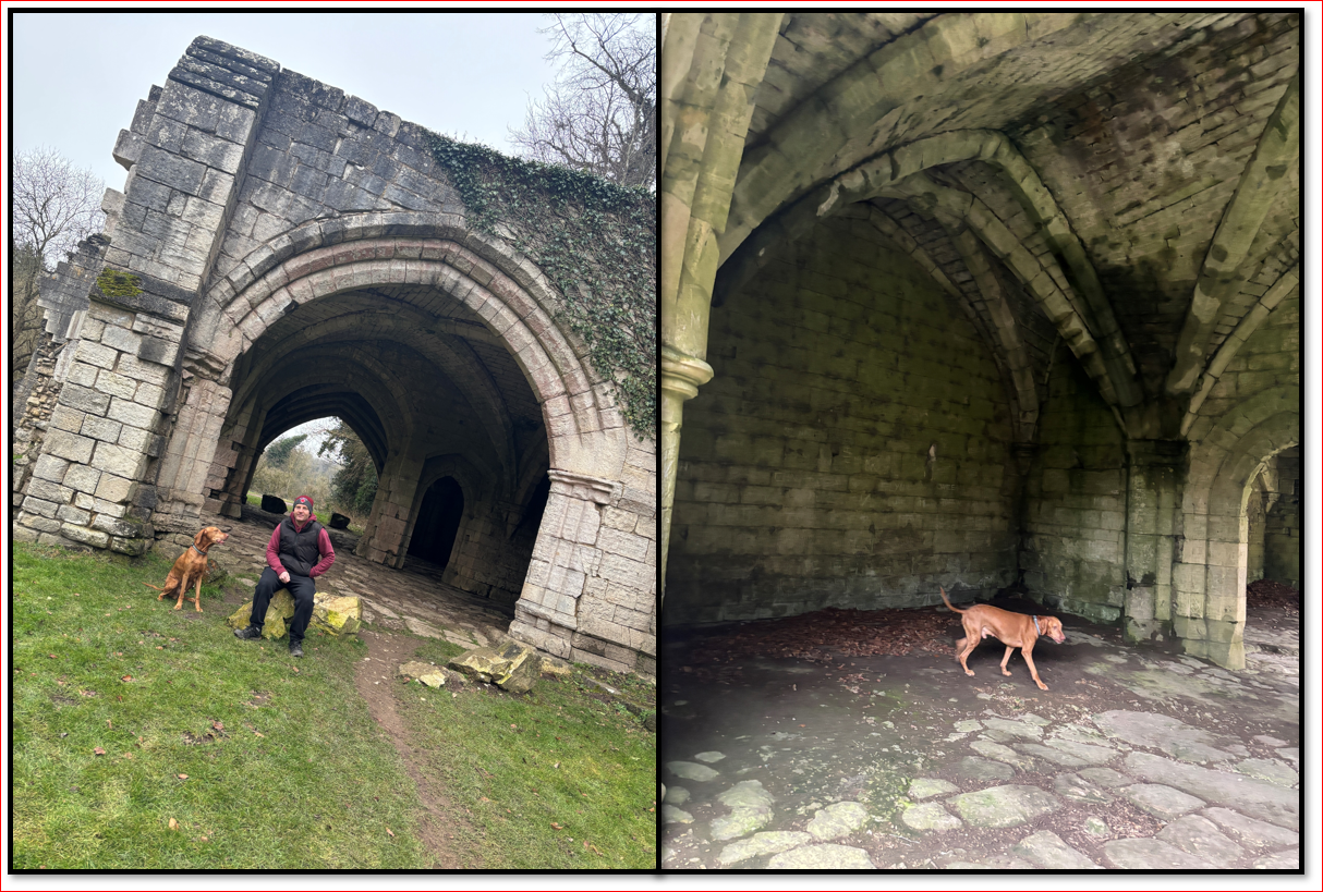
The path runs to the left of the visitor centre, there was a path running adjacent to the Abbey ruins on our right. We could still see fabulous views of the Abbey from the footpath.
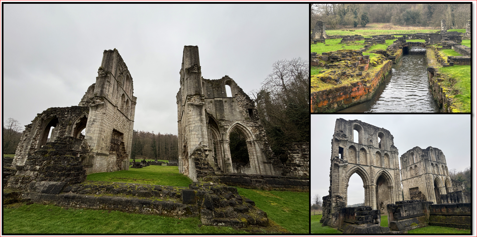
Following the dissolution of the monasteries, Roche was ransacked for building materials. In the late 1700s it was owned by the Earl of Scarborough. The Abbey was re-landscaped by Lancelot 'Capability' Brown and, more recently English heritage removed some of the landscaping to reveal more of the Abbey's remains. More historical information can be found here.
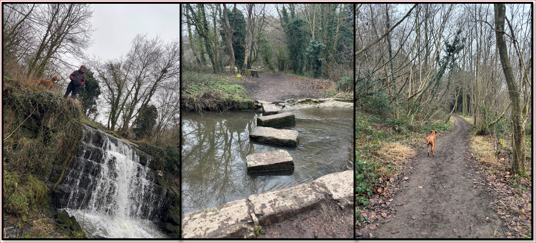
Heading right, following the boundary of the ruins we approached 'Kings Woods'. Entering the woodland there were some wooden paths which led upwards where we found a small but lovely waterfall and some stepping stones at the top. This was unexpected but very pretty. Sadly, the stepping stones were not on our route, and we then continued to follow the directed path through the woods. (We are planning another trip just to explore the stones!)
The woodland was lovely and eventually we came to a fork and followed it up a steeper path to the left until we reached a farmers field. The fields were agricultural and empty, and so we kept Monty off-lead. We prefer walks where he can be free to sniff around, and at 11 years old he doesn't wander far from our side. The next part of the walk involved following field boundaries and did become quite muddy at times. There were breath-taking views across the valley and we kept looking for the Church Spire that we were supposed to head towards but it turned out we were looking in the wrong direction. As the path curved around a treeline, the church spire was revealed in the distance ahead of us.
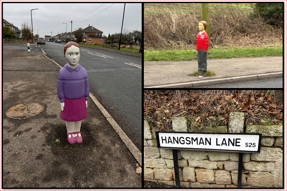
The route then brought us in to Laughton town, where there was a short - but straightforward - street walk, and Monty reluctantly went back on the lead. We joined the country trail again at the side of the Primary and Infants School. Apparently the school is one of the oldest in South Yorkshire and dates back to the reign of Elizabeth I. It also has some rather disturbing (but effective) traffic calming devices outside, and a rather ominous street name!
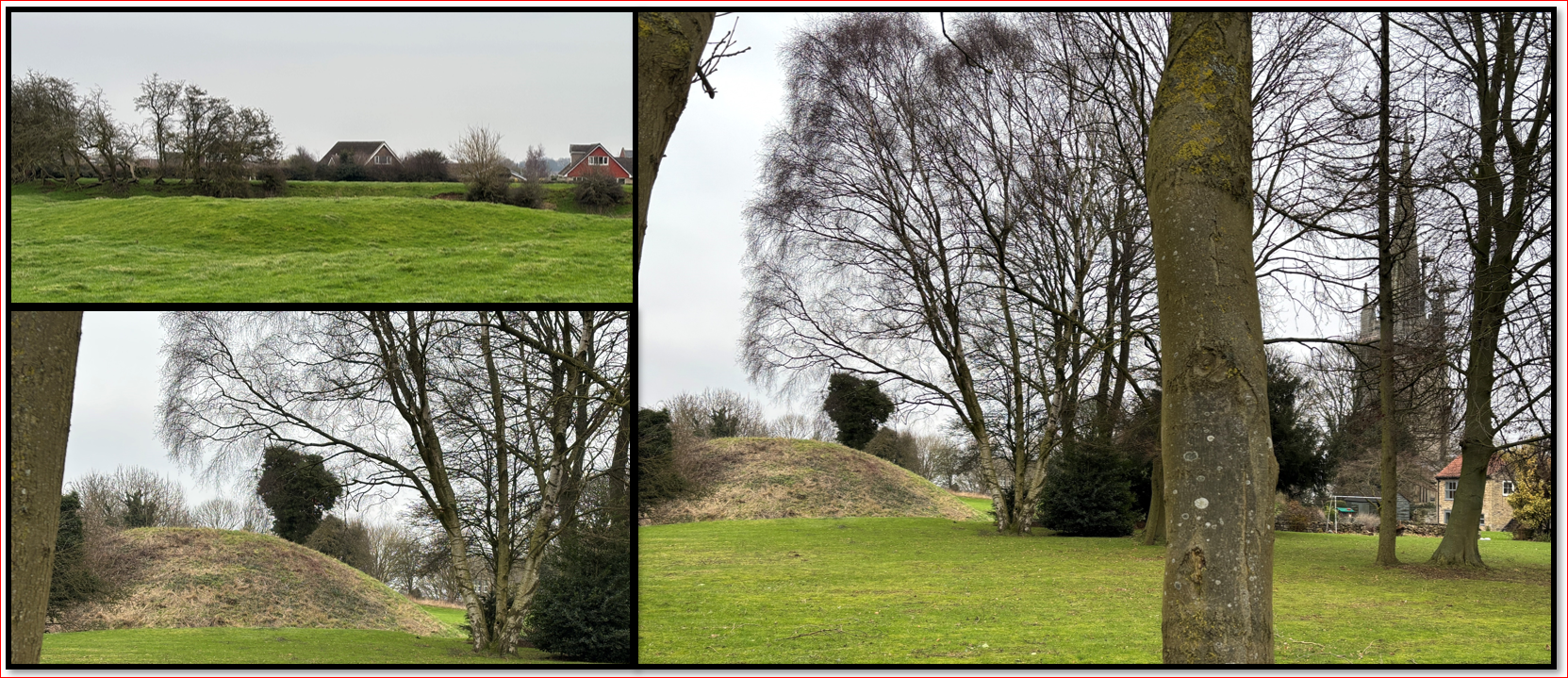
This section of the walk circles behind the Church through an undulating grassy 'meadow' that even to the untrained eye is clearly covering some kind of archaeological remains. These are part of earth works known as Castle Hill. As we returned to a field side track, adjacent to the church we could see the remains of a Motte and Bailey Castle in a mound beside the Church. If you are at all interested in archaeology (I was fortunate enough to take a few electives when studying for my Classics Degree, and I also worked as a volunteer at the Arc in York during my first year at University) then you may find this excavation report from 2019 interesting. We took photographs from the field, but it would be possible to walk through a gate and view them in more detail.
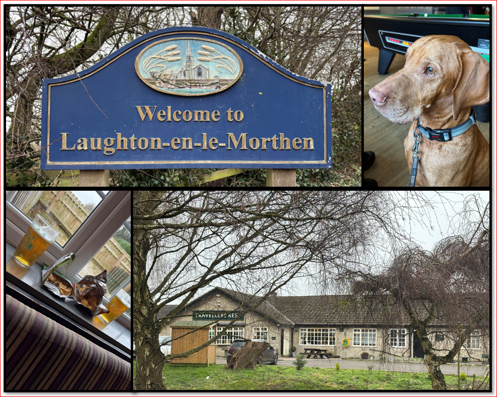
The path along the field was short, and we then crossed a road, heading uphill - there was no footpath for a few metres so be aware. Ahead of us was a rather lovely sign for the Town - it's French name alluding to South Yorkshire's Norman heritage. We then headed left and down Brookhouse Lane. Further down there was is a Public Footpath to the left - just as the road curved and flattens out. This again followed the edge of a field and a building could be seen ahead. This was 'The Traveller's Rest'. We naturally stopped for a pint. The pub building appears to be a 1960's or 1970s structure and so not the appealing 'ye olde worlde' style that we expected. That said, it welcomed dogs and walkers and had a friendly atmosphere. It is part of the Greene King chain, so we enjoyed a pint of 'Priors Rest' and some crisps, before continuing on the final leg of our adventure.
We left the pub car park and turned right. We passed a few houses until a footpath sign directed us left onto a path by the side of one of the gardens. The path was fenced on the right - with a horse field - and we had to negotiate some rather overgrown spruce trees to the left. The path was narrow and did not seem regularly used but it was manageable.
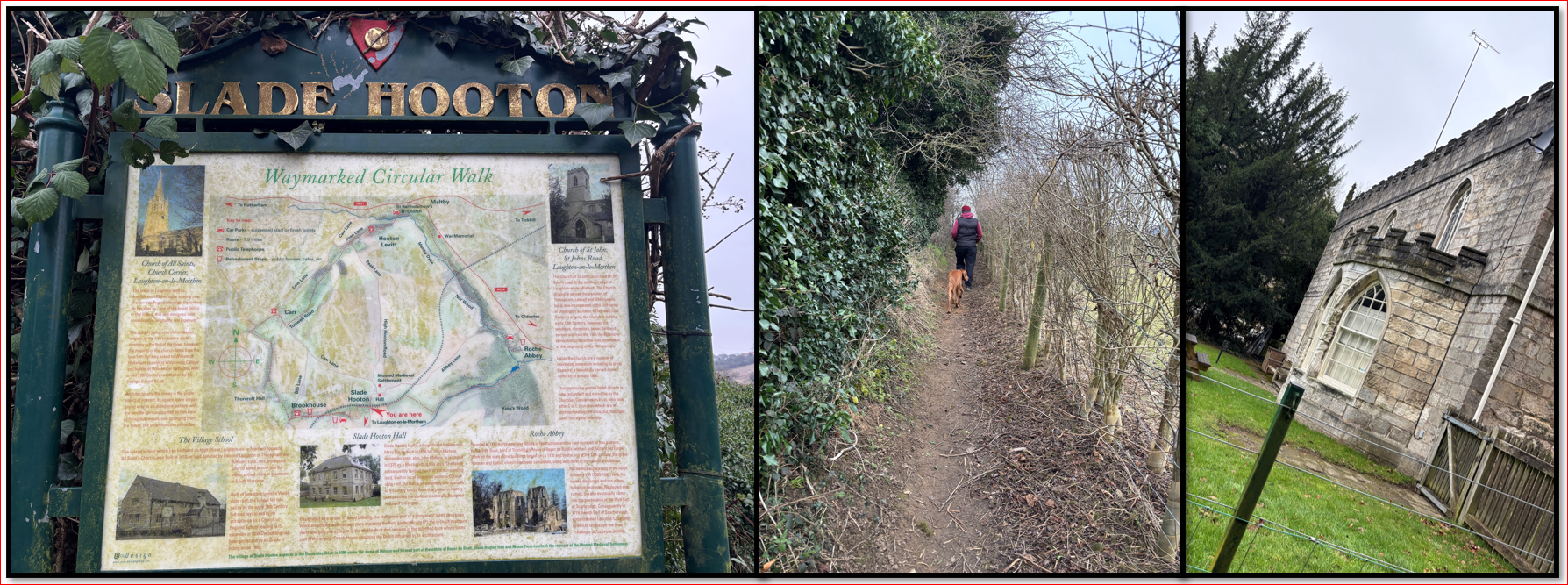
As it reached the railway, it turned right and we followed it over a few stiles. One was a bit tricky for an eleven-year-old Vizsla and so Danny lifted Monty over. The path reached 'Hooton Lane' where we crossed a small road, re-joining the path directly opposite. Here we found another very nice Sign - this time for 'Slade Hooton' - and it had another circular walk route on it!
The footpath eventually opened up into fields and we followed the field boundary ahead until we saw a Public Footpath sign directing us right down the middle of a field. We reached the bottom and followed the path left. There was a lovely stream on our left and the the field continued to the right.
Eventually we came to a small bridge crossing the stream on our right and found ourselves back in Kings Wood. We continued on the path, retracing our original steps back to the waterfall, past the Abbey and visitor Centre, returning to the car park. The visitor centre has a outside area with wooden tables and I imagine it is a very enjoyable place for a picnic in Summer.
The walk was very enjoyable, despite the misinformation regarding its length!
If you want to carry out more paranormal research, it seems that a ghostly horse and carriage have been spotted on Laughton Common, and if you wanted to visit the aptly named 'Gallows Pub' on Hangman's Lane (near the primary school) witnesses have been said to hear the creaking of the gallows rope while enjoying a quiet pint.
We hope that you enjoyed this walk. Our next one is taking us to Thruscross Reservoir and a drowned village. Please subscribe and comment - especially if you try any of the walks we share.